Move Redmond, then known as Greater Redmond Transportation Management Association (GRTMA), commissioned this map for the occasion of the launch of the North Eastside Mobility bus network in March 2020.
The goal was to introduce new and upcoming transit offerings on the Eastside through an engaging and appealing graphic that represents service levels, routing, as well as areas served by the on-demand Community Ride service in a format that is simple to read.
Major transit projects like East Link light rail and Stride BRT on I-405 and SR 522 are shown to give people a preview of the near future. The map builds on the design established four years ago by my Seattle Transit Map while incorporating a brighter tone and more streamlined look.
The map supports Move Redmond’s advocacy efforts for better biking, walking and transit in Redmond. It is available online and possibly in print.
Features
I tried a few new features on this map that I never used before on previous maps.
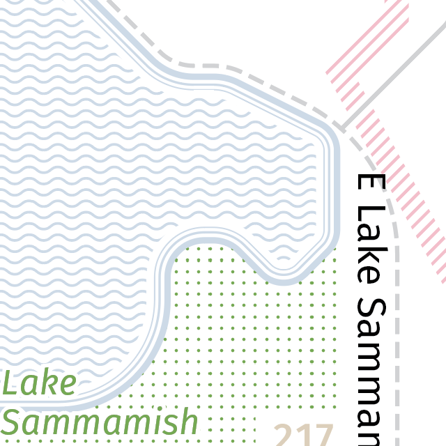
I liked the airy limited ink aesthetic of old-school print maps that used patterns such as dots and lines so for this map I wanted to avoid large blocks of solid color. I used wavy blue lines for the water and thick outlines for the shoreline. Rivers are a stream of lines that flow into lakes. A field of green dots represents parks and open space. Flexible service areas and routes are striped pink lines.
I added clickable areas that are hyperlinked to Move Redmond’s homepage, their action alert sign up form, King County Metro’s website, and Sound Transit’s website.
Timeline
- 2020 March 25 - Map releases on Seattle Transit Blog. Reader feedback is incorporated to refine the map.
- 2020 August 16 - Map updated to current service levels with suspended routes dimmed.
- 2021 March - Minor updates for March service change
- 2021 April 28 - GRTMA became Move Redmond with a new logo. Action alert sign up link added.